| Blackwater | Bowling Green | Cedar | Dresden |
| Elk Fork | Flat Creek | Green Ridge | Heaths Creek |
| Houstonia | Hughesville | La Monte | Lake Creek |
| Longwood | Mount Sterling (historical) | Prairie | Sedalia |
| Smithton | Washington |
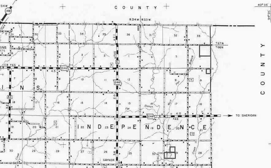
TOWNSHIPS - A 'political' township is different from a 'geographical' township. The political townships are those that are given names. A 'geographical' township is a 6 mile to-a-side area consisting of 36 sections of 1 square mile, and each is numbered, 1 through 36. Townships are designated either North or South, while Ranges are designated either East or West. The cardinal points are referring to the land's position relative to the closest meridians. With all of that said, 7 of Pettis County's 17 'political townships' are pure 'geographical townships' comprising 36 sections...they are: Bowling Green, Dresden, Elk Fork, La Monte, Lake Creek, Prairie, & Smithton.
SECTIONS & ACRES - A section (one square mile) consists of 640 acres. A section is divided into four quarters - the northeast, northwest, southeast and southwest. Then each quarter can also be divided into quarters, and so on. Each one-fourth of a section contains 160 acres. Half of a quarter section would be 80 acres. A fourth of a quarter section would be 40 acres. If a document says the south half of the northeast quarter in section 6, then in that section you would first find the northeast quarter, then cut the section in half and you would have the south half of the northeast quarter.
County maps (example below) are clearly marked with numbered sections.
If you happen to have a county plat book, sometimes called township books, these will be broken down by 'political' townships. However, they do give the township and ranges, and many 'political' townships are larger than 'geographical' townships, and some are smaller.
Should you have a legal description that is given in degrees, minutes and seconds, contact an abstracter or a surveyor.